By Joe Bastardi, CFACT | July 08, 2025
First, I’d like to address the Texas flood. Based on my pre-summer ideas, I thought Texas would experience a hot, dry summer, and an event like this would never have occurred. However, I was wrong, and I’m about to explain why that forecast was incorrect and what I overlooked.
As for this specific event, training thunderstorm activity is notorious for producing flash flood disasters. These storms typically involve warm, tropical air flowing into an area with repeated upward motion, often occurring in hilly regions with narrow streams that channel excessive rainfall into one place. The notion that this disaster was worsened by DOGE cuts is absurd.
The National Weather Service issued flash flood watches 12 hours in advance, warnings three hours in advance, and discussed the setup for this event two days prior, clearly understanding the potential risks. Secondly, if you’re going to blame man-made climate change, you’ll need to explain why countless similar events have occurred in the past.
While not always in the same location, these events happen whenever tropical air is lifted in hilly areas under an upper-level pattern conducive to repeated thunderstorms. If you claim the Gulf of Mexico’s warmer temperatures, driven by CO2, are responsible, your argument does not have a leg to stand on.
In fact, as I’ll explain below, the significant atmospheric cooling that has been occurring since the beginning of the year may have played a larger role. This cooling is a byproduct of large-scale, natural drivers and not CO2, the same way the warming spike and cumulative warming overall is.
When I was younger, I quickly realized I wasn’t as naturally smart or intuitive as others in my field, so I compensated by studying countless maps of past weather events. This gave me a deep appreciation for what the weather had done and what it was capable of doing. It provided me with an edge over many forecasters because when I noticed a pattern, I had likely seen it before. From childhood through college and beyond, I was never alone; the weather was always with me.
I learn a great deal from being “corrected” by the weather, as I hate losing. I could not even tolerate someone beating me at a game like tiddlywinks, so when the weather outsmarts me, I need to understand why and ensure it doesn’t happen again for the same reason. This summer in Texas, the weather is correcting me. After predicting a hot, dry summer centered on Texas, the weather has been the opposite, and I have an idea why.
When I issued the summer forecast, I relied heavily on the European model. I figured the 10-year averages were significant and should carry substantial weight. We knew wetter-than-average conditions were likely in the Southeast and Tennessee Valley, which would limit high temperatures there but lead to warmer-than-average nights, a pattern seen since the super El Niño of 2015-16. This has largely been the case. I saw no reason to deviate from this forecast, as the analogs and data all supported it.
Temperatures:
.png)
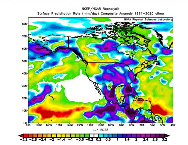
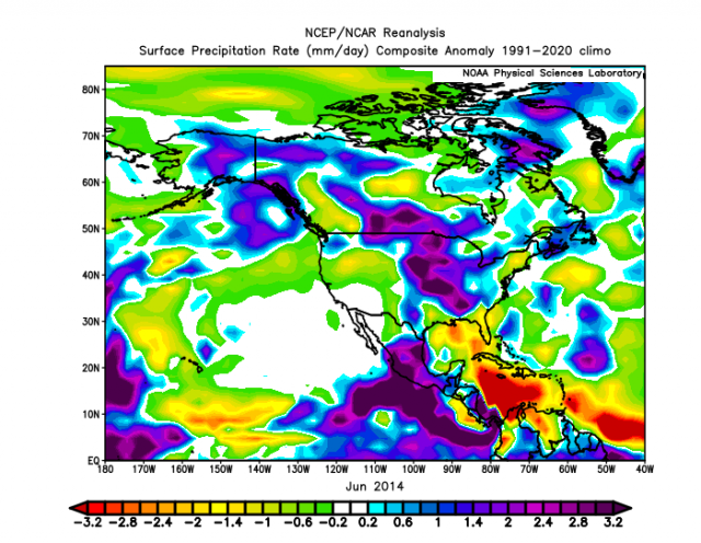
Precipitation:
.png)
TO BE CLEAR, IT IS NOT THE COMPUTER’S FAULT. I WAS WRONG. It’s my fault. The computer is a tool to the answer, not the answer. Oddly enough, I did not think that some of the things I have been preaching about with cooling would be a problem.
Over the past 10 years, since the 15-16 Super Niño, and then piled on with Tonga and the 23-24 El Niño, you simply bet the warm card as excess water vapor (WV) in the air was skewing it. The recent temperature spike was clearly caused by the water vapor input of those 2 events. But what happens if it starts to cool? You have more precipitation in areas where the pattern dictates it. In addition, you have different feedback to the pattern. But it’s not more warming that is causing the precipitation; it’s the sudden cooling that may be causing it.
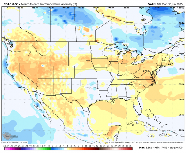
This chart shows that there is a rapid drop off in temperatures occurring now. It started in February.
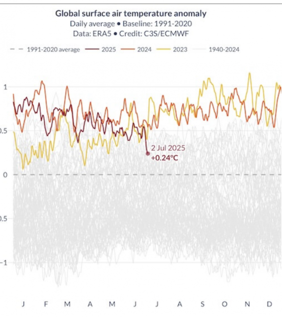
This is the coolest start to a July on the CDAS since before the 15-16 Super Niño.
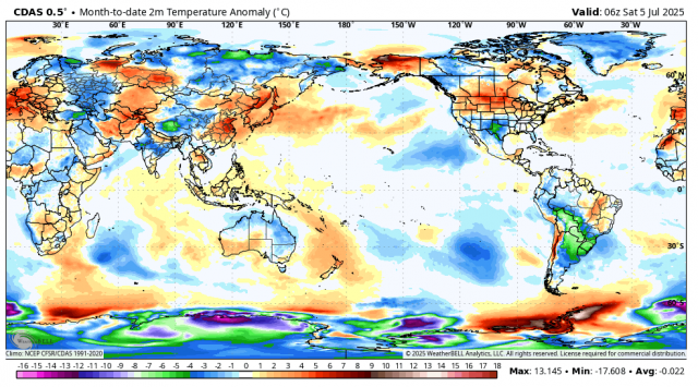
Another strange thing, and totally out of character since 2015, is the South Pole winter. Winters in the polar regions have been warmer than average due to increased WV. Right now in the South Pole, it’s about as cold as you ever see it in a winter season. These are temperatures in relation to the average:
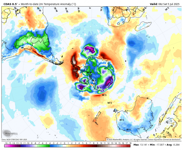
It’s exactly the opposite of the mean July pattern since the 2015-2016 Super Niño.
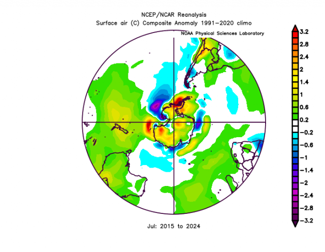
Something is clearly going on here that is not what we have seen. Of course, if you are not looking at the South Pole or the Southern Hemisphere, you are not aware of that. Obviously, I am now.
The Euro computer model has busted every month in Texas since May.
So when it busted in May, I figured as the jet pulled north, the pattern would straighten out and I would be fine.
The Euro’s April forecast for May looked like this:
.png)
When it came out for May, on the 5th, it flipped to this:
.png)
By the way, it turned out like this:
.png)
June was much the same.
The forecast for June a month before:
.png)
5 days into the month, it revised it to this:
.png)
What happened:
So the model is hitting its nowcast, but is helpless beforehand in the south.
July was the same deal.
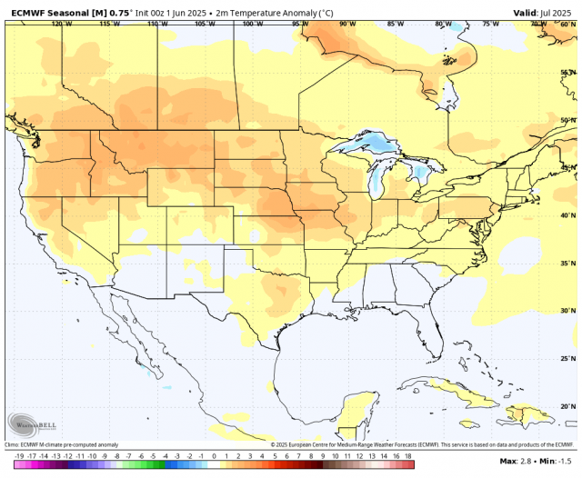
This is the forecast for July issued in June:
Here is where it is now (issued 5 days into the month):
.png)
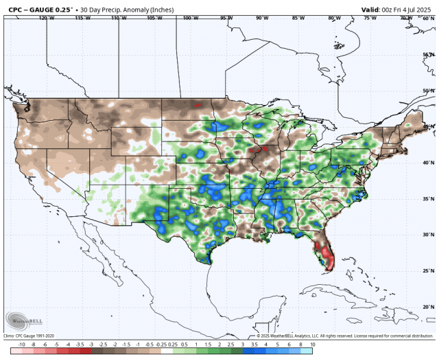
July so far:
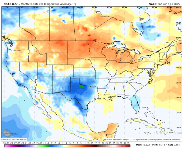
What the model is saying is there is plenty of heat, just not where I thought the center would be before the summer.
Not only that, we have not seen this much rain in June in Mexico and the US since before that 2015-2016 Super Niño.
2014
Gradual warming is a much “safer” climate option than rapid cooling. The atmosphere will adapt to warming and establish a new equilibrium, but sudden cooling is like a cattle prod to the atmosphere.
There is more water vapor available for condensation, so if you get into a pattern favorable for wet weather (which is what I thought we would see, but further east), then it can rain even more. Once the correction is made, you go back to normal. But compare that seasonal forecast for summer on precipitation above with what has happened so far. The rain is further back in Texas.
Wet weather in summer is also a cooling factor, and Mexico could have one of its coolest Julys on record.
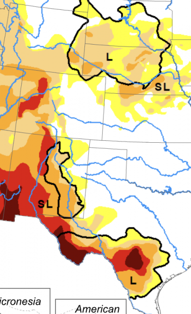
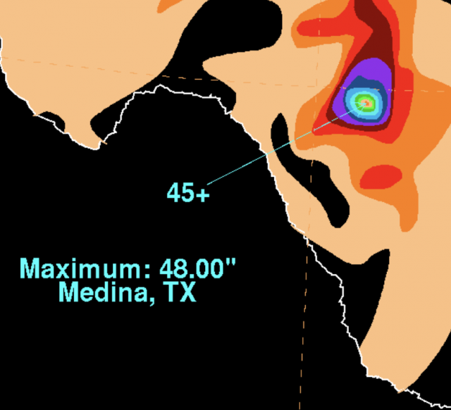
As I opened with, this is not to be taken as the direct cause for the disaster in the hill country of Texas. That area is notorious for feast or famine patterns, long-term droughts, and then heavy rains. In fact, much of the Rio Grande Valley was still in a drought despite the rainfall.
This event was not too far off from that weak tropical storm in 1978, Amelia, which dumped 48 inches of rain near Medina, Texas.
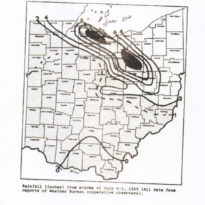
Though not in Texas, July 4th, 1969, was the anniversary of a destructive derecho that crushed NE Ohio.
If you live here in Pennsylvania, you know what happened with the July 1977 Johnstown flood. You don’t need a tropical system, just focused tropical inflow, and the stage can be set. July is notorious for this kind of thing.
The subject here, though, is the large drop that has been occurring and the possibility that it is a forecast headache, not only now but going forward.
Let’s keep in mind that in several of my blogs on the geothermal input situation, I have been saying a test is coming of the idea. I don’t think the dropping off of input, the rapid drop off in sea surface temperatures, and now the global temperatures (there is a lag) are coincidence.
.png)
If this is the start of the test, then I lost the first battle. But it’s something I am now aware of, and hopefully the correction will lead to better ideas down the road.
Computer models cannot anticipate such things until they get hold of the input, and as I have shown many times, we are woefully behind on the amount of data we should be getting from the deep ocean, especially in areas where there can be large variations in geothermal input. So if we see a continued drop-off, then the test has begun. As I said, I don’t like being wrong.
It’s not easy to write a blog admitting this kind of error, especially when some of my critics were hammering me on that dry forecast when I put it out. But if it turns out it was not a setback overall but a setup to be better, then I guess it’s worth it. For now, this is a dissection of a busted forecast, and at the very least, something you don’t see all the time in the field of climate and weather.
The summer is turning out with large-scale heat, by the way, but the core of the heat is further north when it’s all said and done.
Joe Bastardi is a pioneer in extreme weather and long-range forecasting. He is the author of “The Climate Chronicles: Inconvenient Revelations You Won’t Hear From Al Gore — and Others” which you can purchase at the CFACT bookstore.
Original article link


