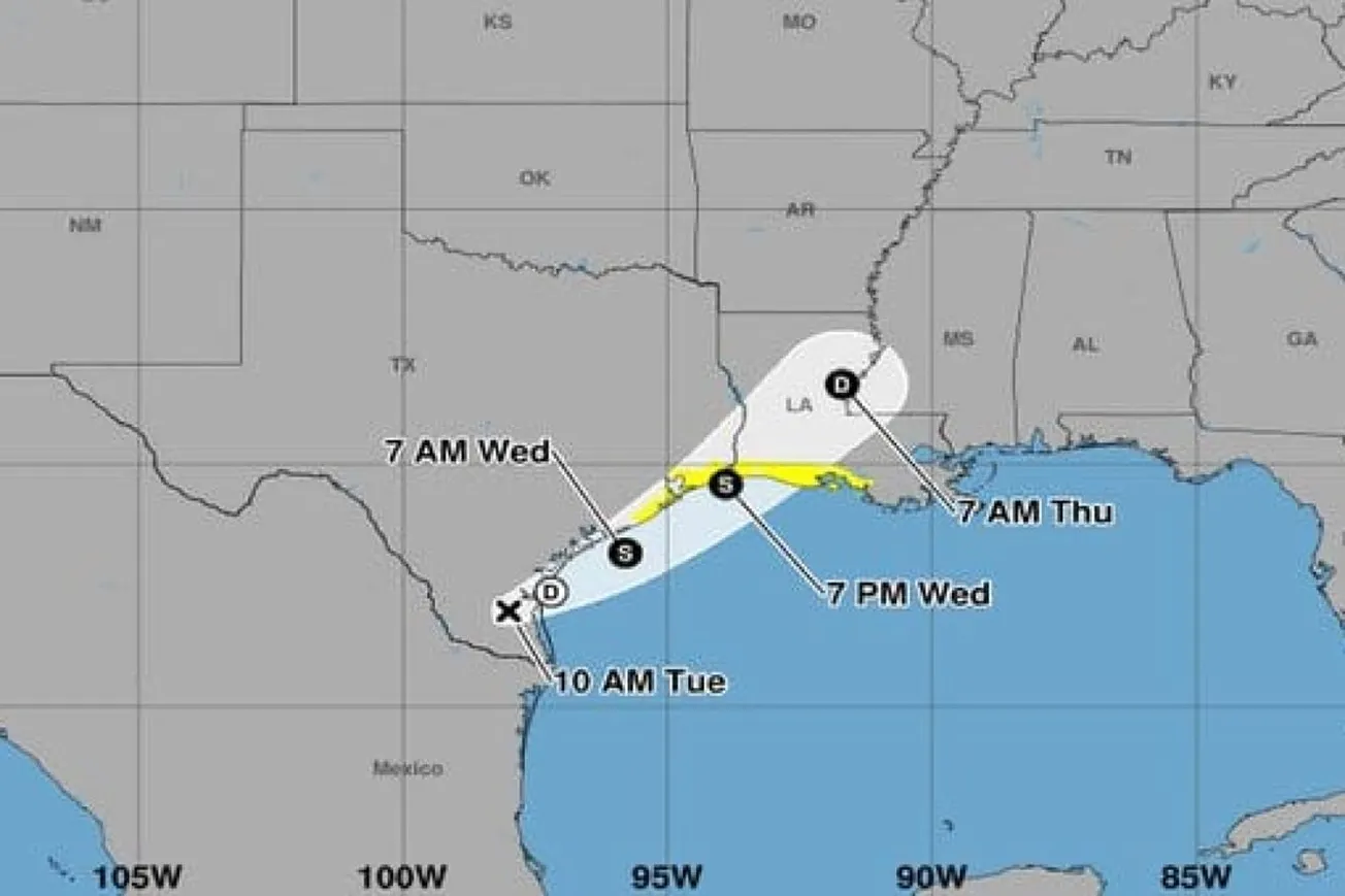
Forecasters at the National Hurricane Center are closely monitoring a weather disturbance over northeastern Mexico that could develop into a tropical storm as it moves into the northwestern Gulf of Mexico later this week.
The system is currently associated with a trough of low pressure located inland over Mexico. Meteorologists expect it to move toward the Gulf, where environmental conditions may become favorable enough for limited tropical development by Wednesday or Thursday.
If the system strengthens into a named storm, it would receive the name Arthur.
Southern and eastern Texas, as well as parts of Louisiana and Mississippi, could experience intense downpours capable of triggering flash flooding, urban flooding, and rising river levels.
Forecasters are also monitoring the potential for gusty winds, rough coastal conditions, and localized coastal flooding.
Emergency management officials are encouraging residents in potentially affected areas to stay informed and review preparedness plans.
While the storm's exact track and intensity remain uncertain, meteorologists stress that flooding impacts could occur even if the system never fully develops into a tropical cyclone, making rainfall the primary concern in the days ahead.
Related Tweet:
The system will bring "intense rainfall" in parts of Texas, Louisiana and Mississippi, even if it doesn't earn the name "Arthur." https://t.co/upiC1sLabj
— USA TODAY (@USATODAY) June 16, 2026
Also Read:


